Roznov pod Radhostem - Dolni Becva - Prostredni Becva - Pustevny - Roznov pod Radhostem
This trip is suitable for true cycling enthusiasts. It is demanding both in terms of the number of kilometers and the elevation gain.

Information for visitors
Interesting facts Roznov pod Radhostem - Dolni Becva - Prostredni Becva - Pustevny - Roznov pod Radhostem
In Rožnov itself, it is pleasant to stop for a while in the Wallachian Open-Air Museum, where you can see local animated exhibits or have some of the traditional Wallachian dishes.
At the main gate of this area, your journey begins - cycle route No. 6260 (Bečva). As its name suggests, it leads around the river Rožnovská Bečva in the environment of the Městský sad park. It meanders around the city swimming pool, car camp, ponds and finally the golf course.
To avoid heavy traffic, continue along it in the villages of Dolní Bečva and Prostřední Bečva. In the latter village, however, be careful not to cross an important turnoff at the Zavadilka hotel. Its beginning is kept as a blue lane marking. However, it is an asphalt road leading directly to Pustevny.
It is this section of the road that will be the most difficult in terms of distance and elevation gain. Its first part, still leading through Prostřední Bečva and the cottage area, does not yet suggest this. The road begins to rise more markedly from the crossroads with the village of Kněhyně. From this point, the road leads through a wooded area. The next small stop on your way may be the settlement "V huti". On the Kněhyna stream, flowing on the left side of the asphalt road, it is possible to observe cascades and waterfalls in some places.
The steepest part of the ascent leads over six serpentines, at the last of them the marking of the cycle route No. 46 will be added to your path and this will lead you along the road to the Skalíkova louka crossroads, where there is a car park behind the bend Pusteven.
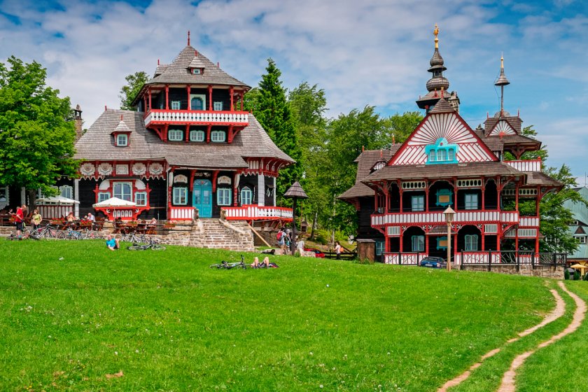
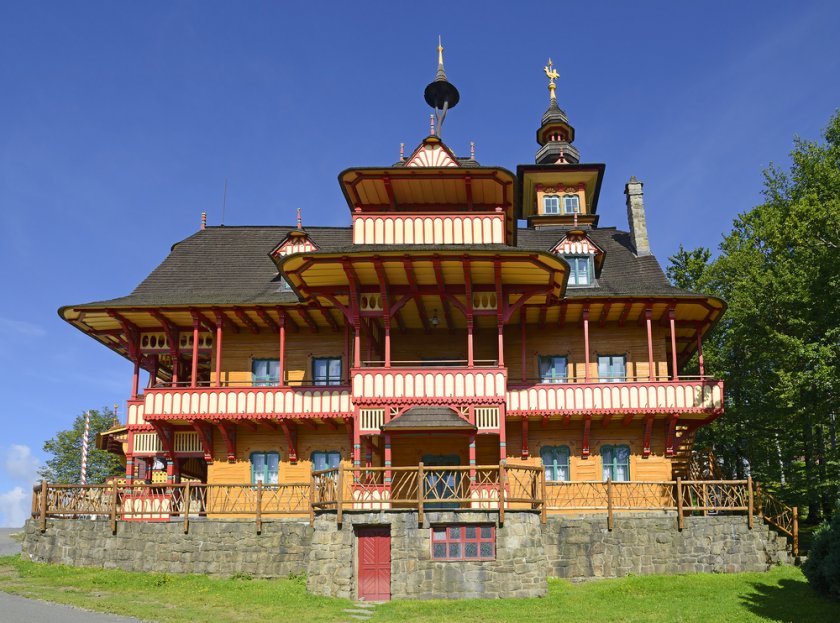
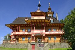
This is significant especially thanks to the buildings of the architect Jurkovič - colorful Wallachian log cabins. Of course, there is also a restaurant, a buffet and, in the summer months, several stalls with souvenirs and local delicacies. Some of you can also go on foot along the blue sign to the gazebo, the statue of Radegast or about 7 kilometers of ridge to the top of Radhoště.
To return to Rožnov, it is possible to use the same route, which is probably the most convenient and fastest ever. However, if you feel like going through the top of the mountains and trying something new, continue on cycle route No. 46. The road leads mainly along the contour line, along the forest paved road. There are several wells around its entrance. In the end, more daring riders can choose the route along the red mark, which, however, drops very sharply. The end of both routes ends at Radhošťská Street.
Author: Martina Zapletalová